File:Potomac River Bridge Iron Bridge from VA Side.JPG
Original file (960 × 639 pixels, file size: 293 KB, MIME type: image/jpeg)
Summary
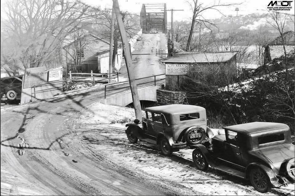
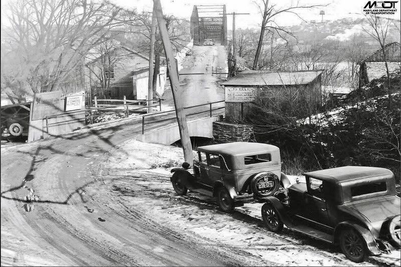
According to the photo description on the "Life in Maryland" Facebook page about crossing the old 1893 iron bridge from Loudoun County, VA to Brunswick, MD:
"Brunswick MD, circa 1932. This image depicts the Virginia side of the bridge, where a tollgate and tollhouse operated until 1934. The road crosses a small concrete arch built into an older stone abutment. Signs along the roadway advertise businesses in Brunswick. On the bridge, a horse drawn carriage is just visible ahead of a following car."
The older stone abutment was one of the piers of the 1857 covered bridge that was destroyed by the Confederate Army in June, 1861. The 1893 iron bridge was built on its piers.
The tollgate and tollhouse are visible on the left side of the bridge entrance. We're not sure about the two structures on the right.
The second advertising sign on the left appears to read, "Brunswick Chamber of Commerce welcomes you." Looks like a L.B. Darr sign on the right.
(Photo credit - MDOT via Life in Maryland)
File history
Click on a date/time to view the file as it appeared at that time.
| Date/Time | Thumbnail | Dimensions | User | Comment | |
|---|---|---|---|---|---|
| current | 21:32, 2 November 2025 | | 960 × 639 (293 KB) | Pwenner (talk | contribs) | According to the photo description on the "Life in Maryland" Facebook page about crossing the old 1893 iron bridge from Loudoun County, VA to Brunswick, MD: "Brunswick MD, circa 1932. This image depicts the Virginia side of the bridge, where a tollgate and tollhouse operated until 1934. The road crosses a small concrete arch built into an older stone abutment. Signs along the roadway advertise businesses in Brunswick. On the bridge, a horse drawn carriage is just visible ahead of a following... |
You cannot overwrite this file.
File usage
There are no pages that use this file.